(main menu)
CAMPBELL
articles
CHARTS
menu
SITEMAP
site is
ABOUT
NEW

|
|
(main menu) |
CAMPBELL articles |
CHARTS menu |
|
SITEMAP |
site is ABOUT |
NEW |
|
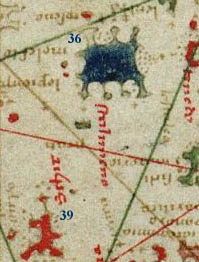
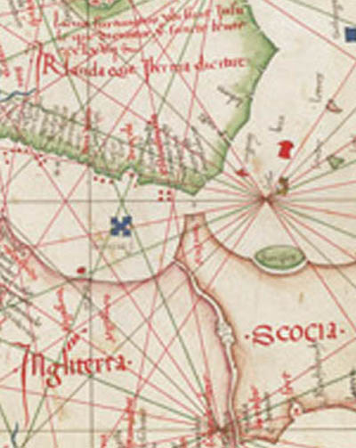
| Section 1: The British Isles and Surrounding Islands [1-10] | |
|---|---|
|
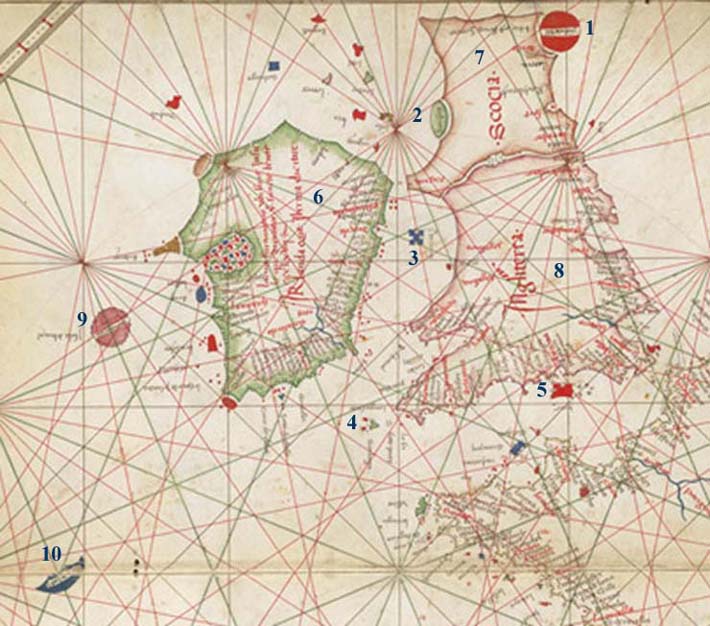 |
| Extract from the 1473 Grazioso Benincasa atlas, Egerton MS.2855 - Courtesy of the British Library. See the full scan here | |
| Section 2: The Canary Islands [11-17] | |
|---|---|
|
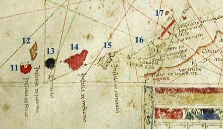 |
| Extract from the 1489 Albino de Canepa chart - Courtesy of the James Ford Bell Library, University of
Minnesota. See the full scan here |
|
| Section 3: The Western Mediterranean [18-29] |
|---|
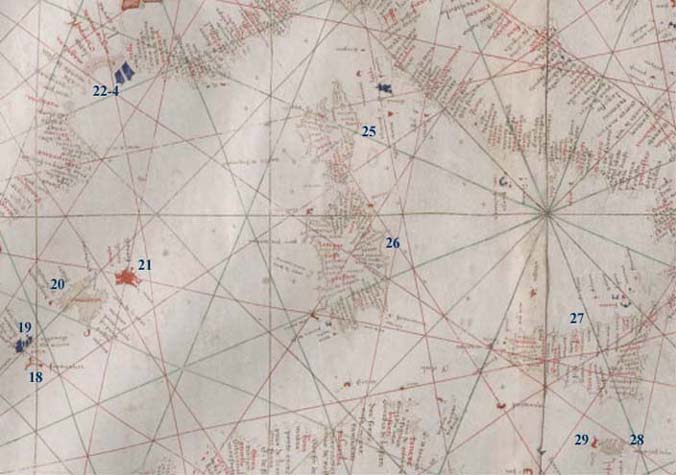
Balearic Islands
Rhône Delta
Central Mediterranean
|
| Extract from the 1403 Francesco Beccari chart - Courtesy of the Beinecke Library, Yale University.
See the full scan here [requires MrSID browser] |
| Section 4: The Ionian Islands and Aegean [30-40] | |
|---|---|
|
Ionian Islands
Aegean
|
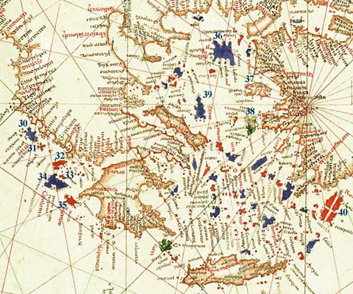 |
| Extract from the 1489 Albino de Canepa chart - Courtesy of the James Ford Bell Library, University of
Minnesota. See the full scan here |
|
| Section 5: The Black Sea [41-47] |
|---|
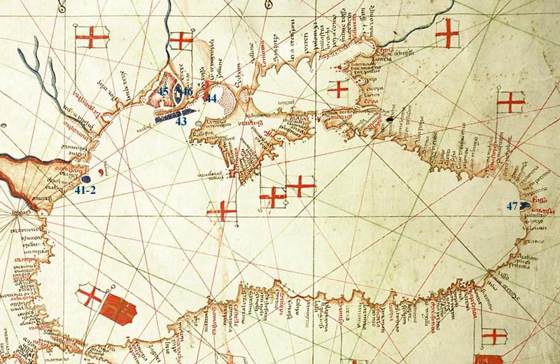
Danube Delta
Dnipro Estuary
East Coast
|
| Extract from the 1489 Albino de Canepa chart - Courtesy of the James Ford Bell Library, University of
Minnesota. See the full scan here |
| Section 6: The Nile Delta [48-51] | |
|---|---|
|
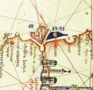 |
| Extract from the 1489 Albino de Canepa chart - Courtesy of the James Ford Bell Library, University of
Minnesota. See the full scan here |
|
| The protuberances on Majorca and Minorca |
|---|
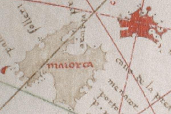 |
| Extract from the 1403 Francesco Beccari chart - Courtesy of the Beinecke Library, Yale University.
See the full scan here |
| The detached initial 'a' of Aigues Mortes | |
|---|---|
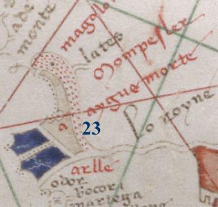 | |
| Unusually, in
this case the 'a' has been repeated. Extract from the 1403 Francesco Beccari chart - Courtesy of the Beinecke Library,
Yale University. See the full scan here | |
| The distinctive shapes of Paxos [31] and Zakynthos [35] |
|---|
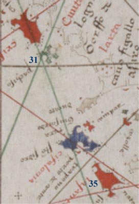 |
| Extract from the 1403 Francesco Beccari chart - Courtesy of the Beinecke Library, Yale University.
See the full scan here [requires MrSID browser] |
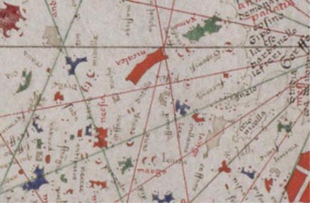
| The line of islands between Euboea and Rhodes formed of the Cyclades and
Dodecanese, demonstrating the use of consistent mnemonic island shapes | |
|---|---|
 |
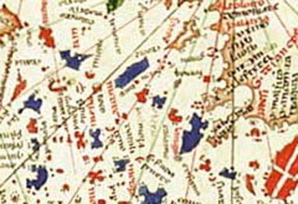 |
| Extracts: left, from the 1403 Francesco Beccari chart - Courtesy of the Beinecke Library,
Yale University - see the full scan here
[requires MrSID browser]; right, from the 1489 Albino de Canepa chart - Courtesy of the James Ford
Bell Library, University of Minnesota - see the full scan here |
|
| The characteristic Benincasa headings for the three parts of the British Isles |
|---|
 |
| Extract from the 1473 Grazioso Benincasa atlas, Egerton MS.2855 - Courtesy of the British Library. See the full scan here |